FROM SEISMIC TO SIMULATION-READY MODELS
CASE STUDY: MAUI FIELD
Lucas Tortarolo, Geoscientist, Eliis & Gavin Elliot, Exploration Geologist, Genel Energy
An innovative 3D stratigraphic framework derived from seamlessly integrating seismic stratigraphy workflows and vector space gridding in PaleoScan™ offer new perspectives on Maui Field development.
CASE STUDY AT A GLANCE
LOCATION
Taranaki Basin, New Zealand
SURFACE AREA
680 KM2
AGE OF SEDIMENT
Late Cretaceous to Miocene
GEOLOGICAL CONTEXT
Low-relief fault-bounded anticlinal structure, multi-directional rifting
DEPOSITIONAL ENVIRONMENT
Stacked fluvial to deep marine channel systems
MAIN CHALLENGES
Multi-story, multi-source and multi-directional sedimentary supply & flow
LOCATION
The Taranaki Basin is located off the west coast of New Zealand’s North Island, extending both onshore and offshore.
AUTHOR

Nicolas Daynac
Advisor - Principal Geoscientist
SYNOPSIS
The Maui Field lies within the Taranaki Basin, New Zealand’s only known commercially producing hydrocarbon province. Its geological history, marked by complex turbidite deposition, provides a compelling framework for stratigraphic modeling and reservoir characterization.
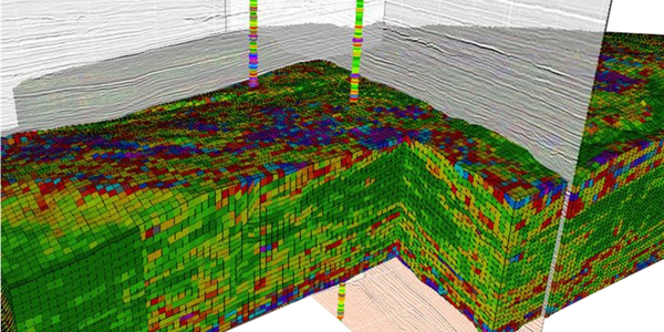
This case study demonstrates how PaleoScan™ technology was applied to build simulation-ready reservoir models from seismic data in the Maui Field. A 3D Relative Geological Time (RGT) model allowed for precise delineation of stratigraphic surfaces and bedset terminations, enabling enhanced interpretation of channelized turbidite systems. Spectral decomposition and RGB-blend visualizations highlighted geobodies, while multi-frequency classification techniques aided their extraction. The RGT grid was populated with rock properties at seismic resolution using well log data, supporting detailed property modeling for simulation. The result is a high-resolution stratigraphic framework that captures heterogeneity and supports development planning.
KEY TOPICS
- 3D RGT stratigraphic modeling and Wheeler transform
- Turbidite system and geobody identification using spectral decomposition
- Frequency classification and RGB blending
- Seismic-to-simulation rock property modeling
- Multi-story reservoir architecture analysis
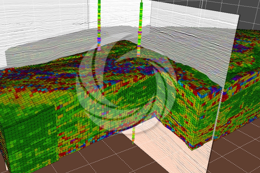
Well log property propagation
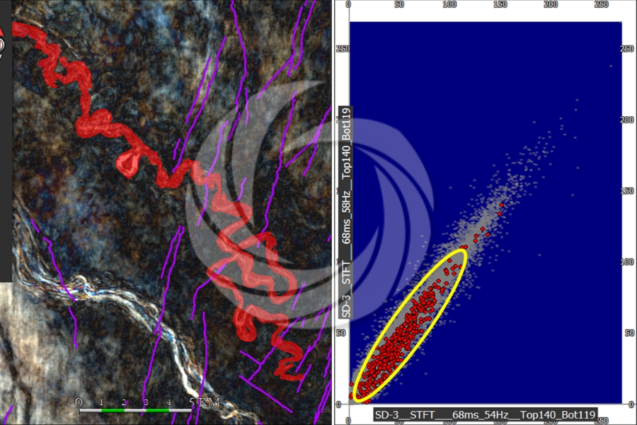
Spectral decomposition and geobody identification
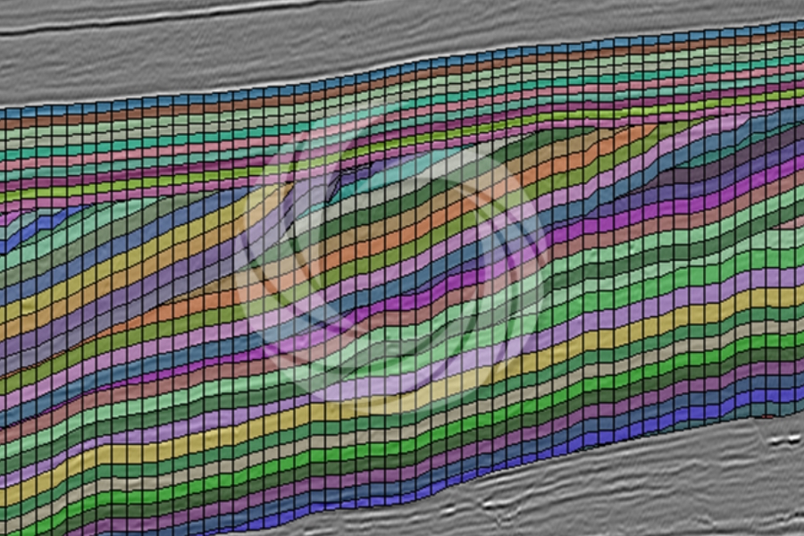
Stratigraphic bedset gridding
WANT TO DIVE DEEPER? DOWNLOAD THE FULL CASE STUDY BELOW!